Tour the Towpath
  • About Us Our Work Contact
  • Boat Float 2025
  • Bicentennial
  • Location Everyday Paddling History Wildlife Fish Species Bike Rentals Where To Stay
  • Gallery
  • What is a LWRP? Waterfront Revitalization Area Public Input Inventory and Proposed Projects Old Erie Canal Water Study
  • Communities Syracuse DeWitt Fayetteville Chittenango Canastota Wampsville Oneida Rome
Tour the Towpath
  • Who We Are/
    • About Us
    • Our Work
    • Contact
  • Boat Float 2025/
  • Bicentennial/
  • Experience the Canal/
    • Location
    • Everyday Paddling
    • History
    • Wildlife
    • Fish Species
    • Bike Rentals
    • Where To Stay
  • Gallery/
  • LWRP/
    • What is a LWRP?
    • Waterfront Revitalization Area
    • Public Input
    • Inventory and Proposed Projects
    • Old Erie Canal Water Study
  • Communities/
    • Communities
    • Syracuse
    • DeWitt
    • Fayetteville
    • Chittenango
    • Canastota
    • Wampsville
    • Oneida
    • Rome
Last Interpretative Sign near intersection with Buck St.JPG
Tour the Towpath

History

Tour the Towpath
  • Who We Are/
    • About Us
    • Our Work
    • Contact
  • Boat Float 2025/
  • Bicentennial/
  • Experience the Canal/
    • Location
    • Everyday Paddling
    • History
    • Wildlife
    • Fish Species
    • Bike Rentals
    • Where To Stay
  • Gallery/
  • LWRP/
    • What is a LWRP?
    • Waterfront Revitalization Area
    • Public Input
    • Inventory and Proposed Projects
    • Old Erie Canal Water Study
  • Communities/
    • Communities
    • Syracuse
    • DeWitt
    • Fayetteville
    • Chittenango
    • Canastota
    • Wampsville
    • Oneida
    • Rome

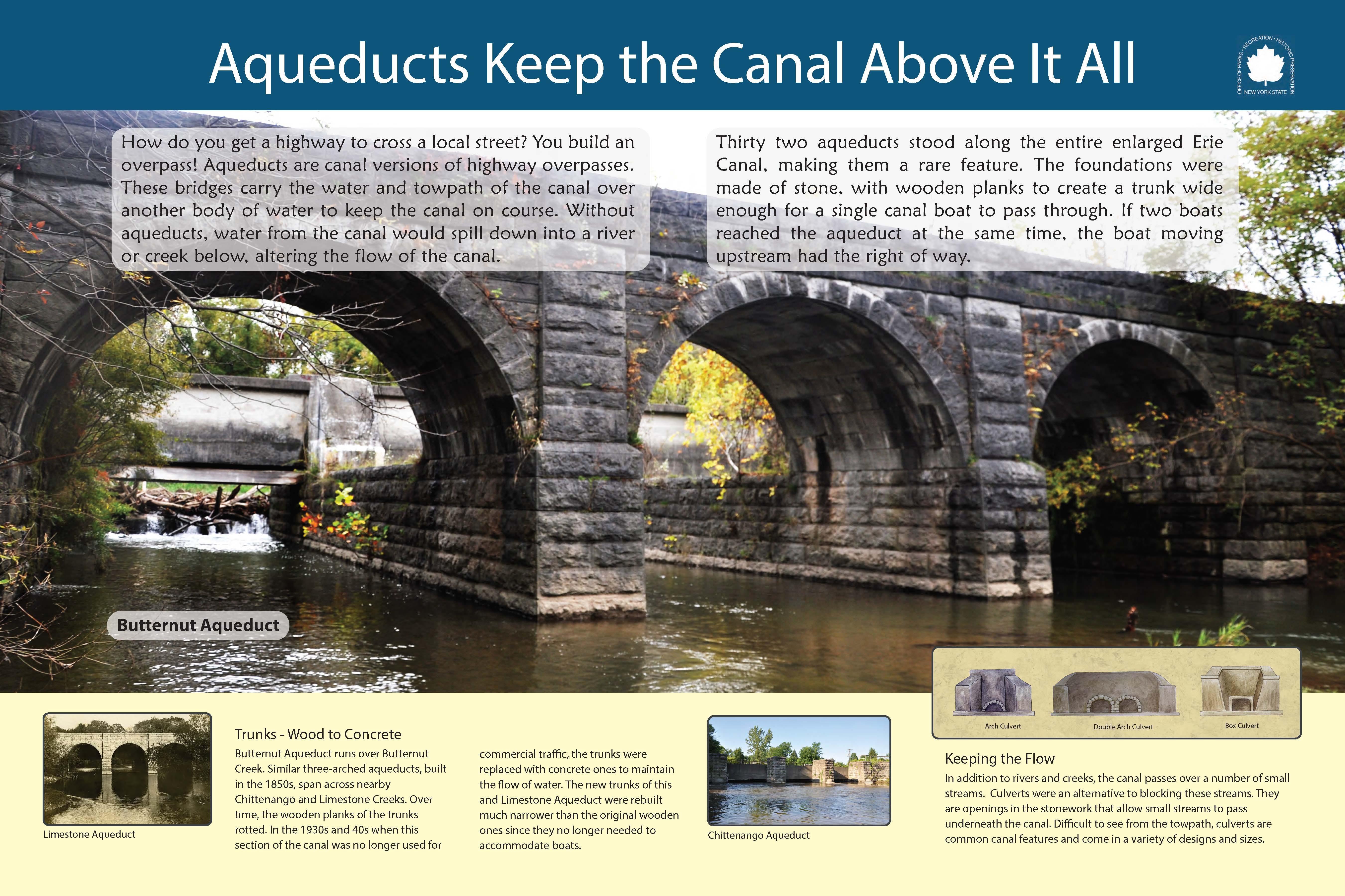
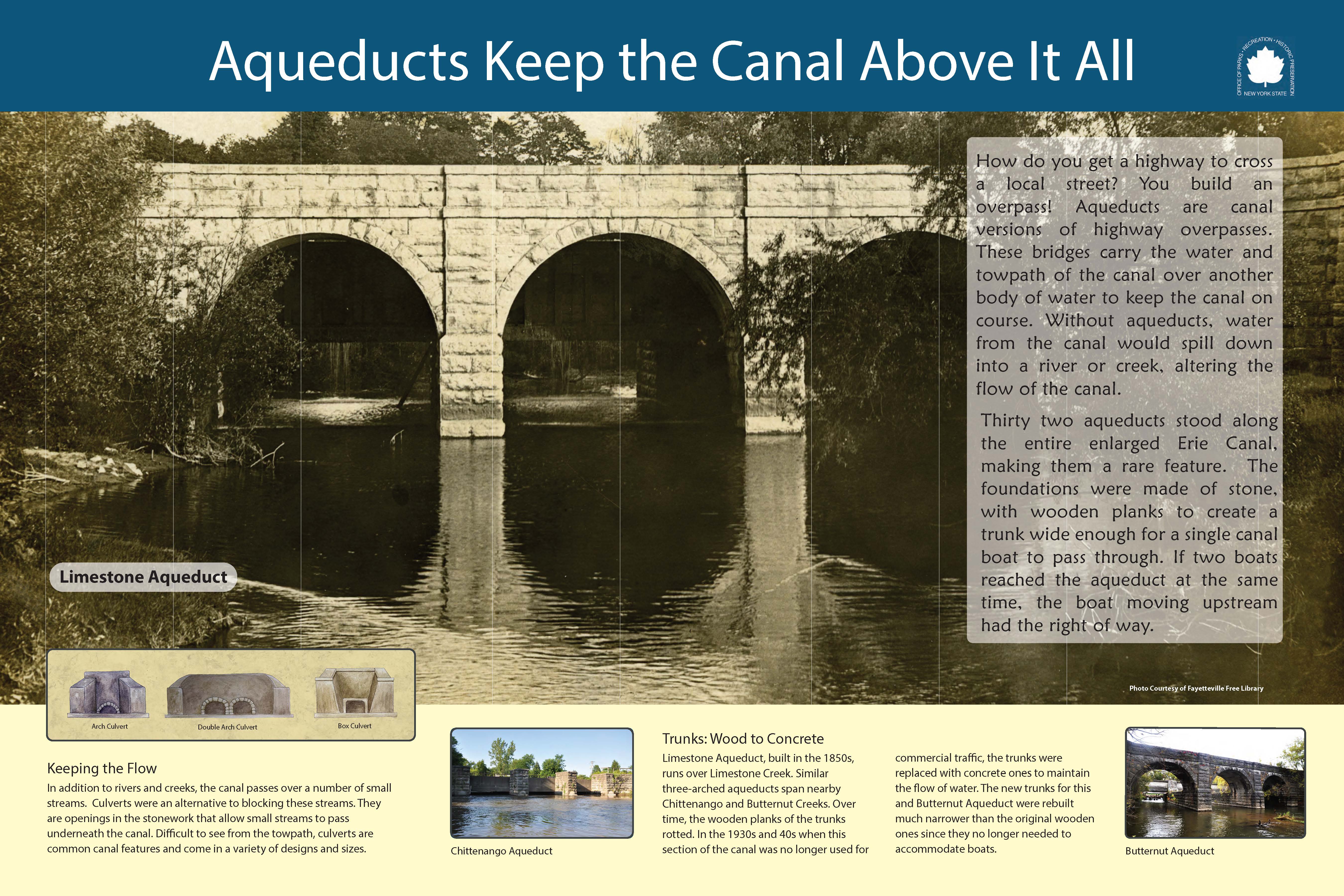
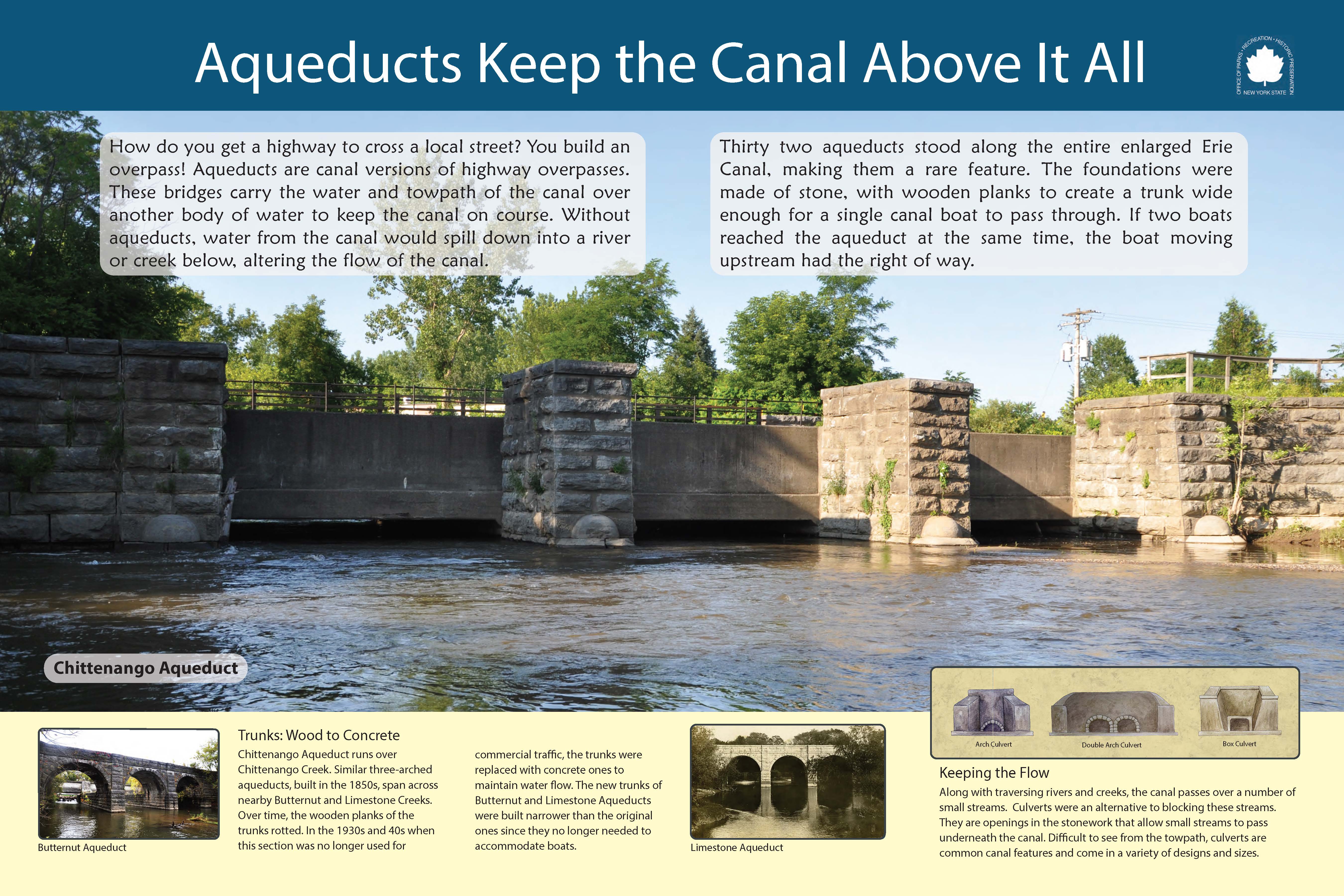
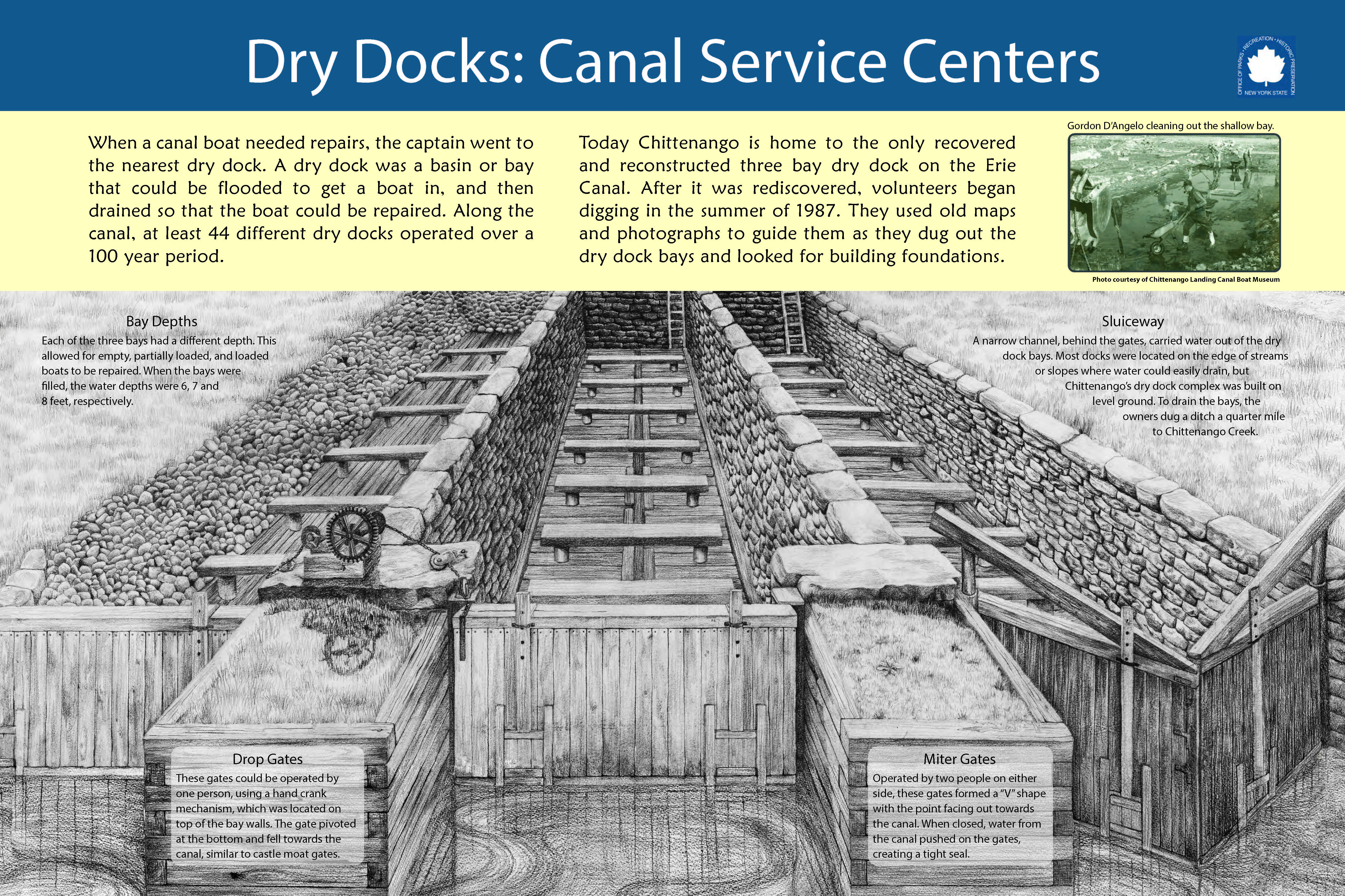
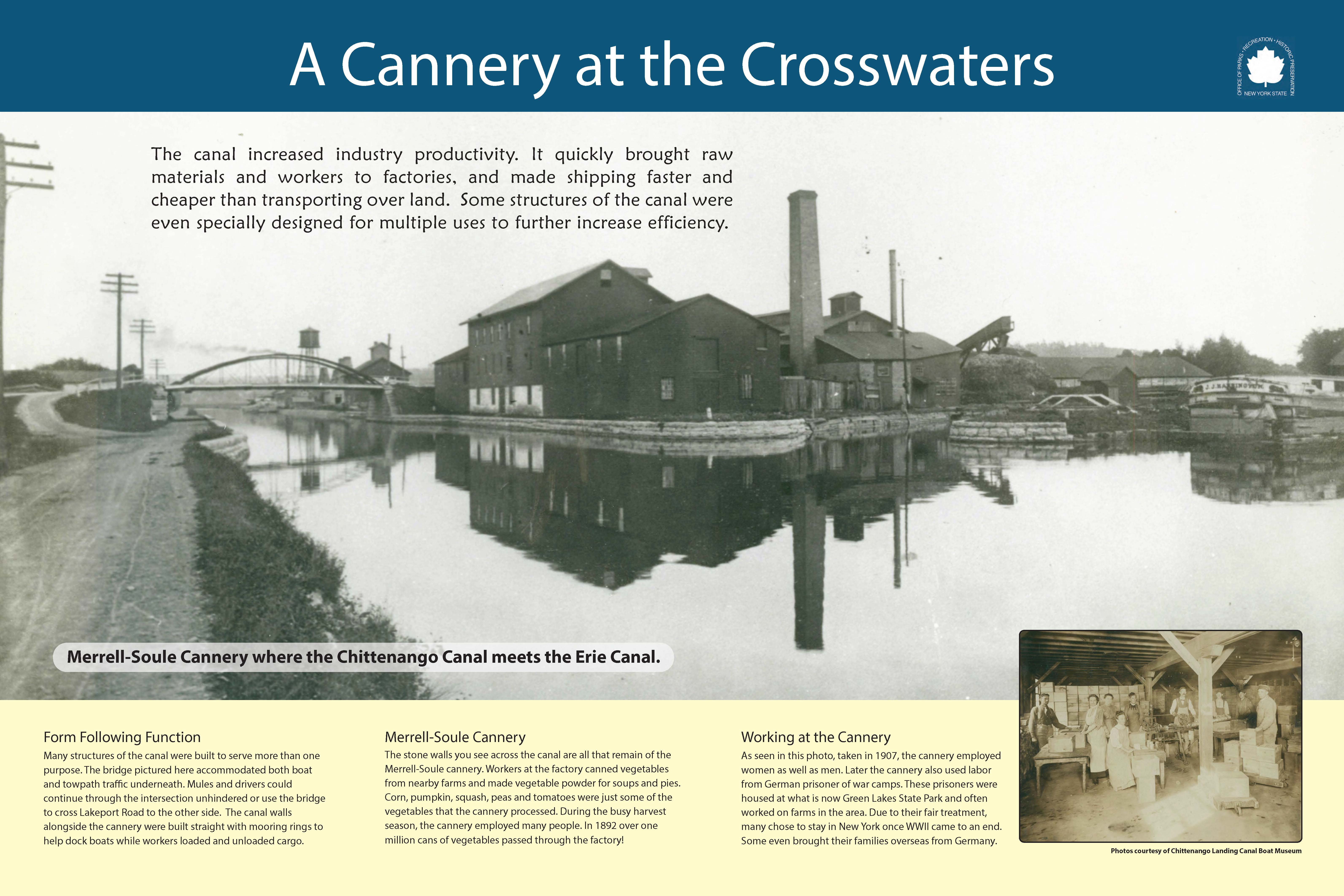
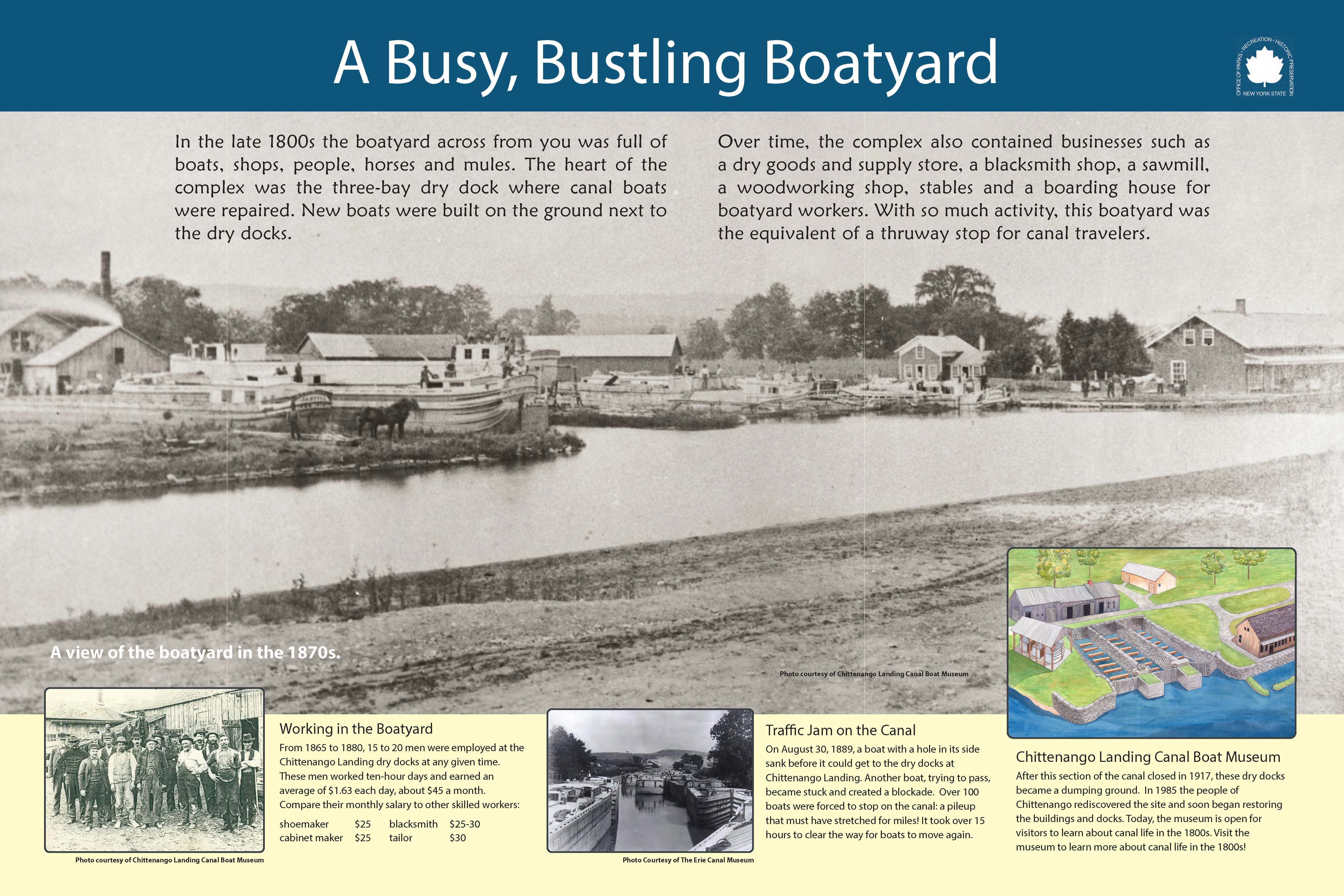
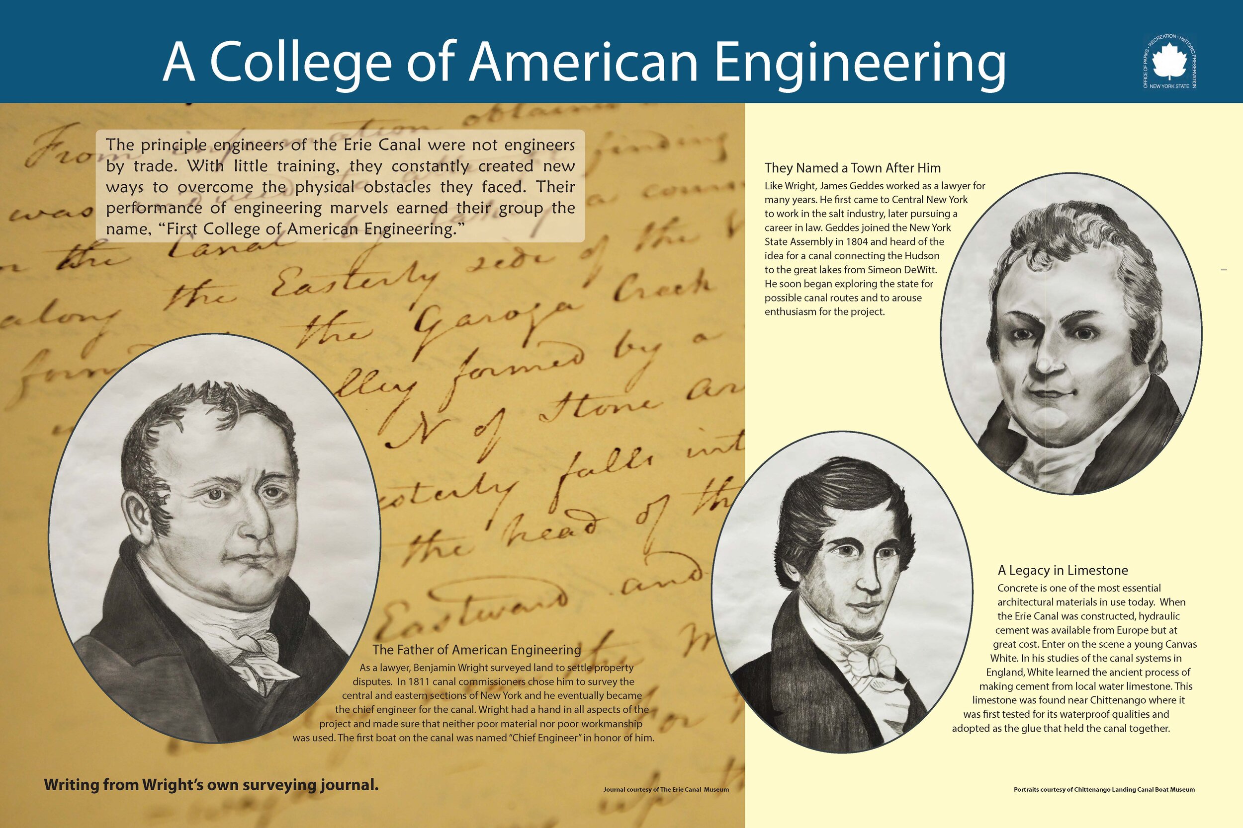
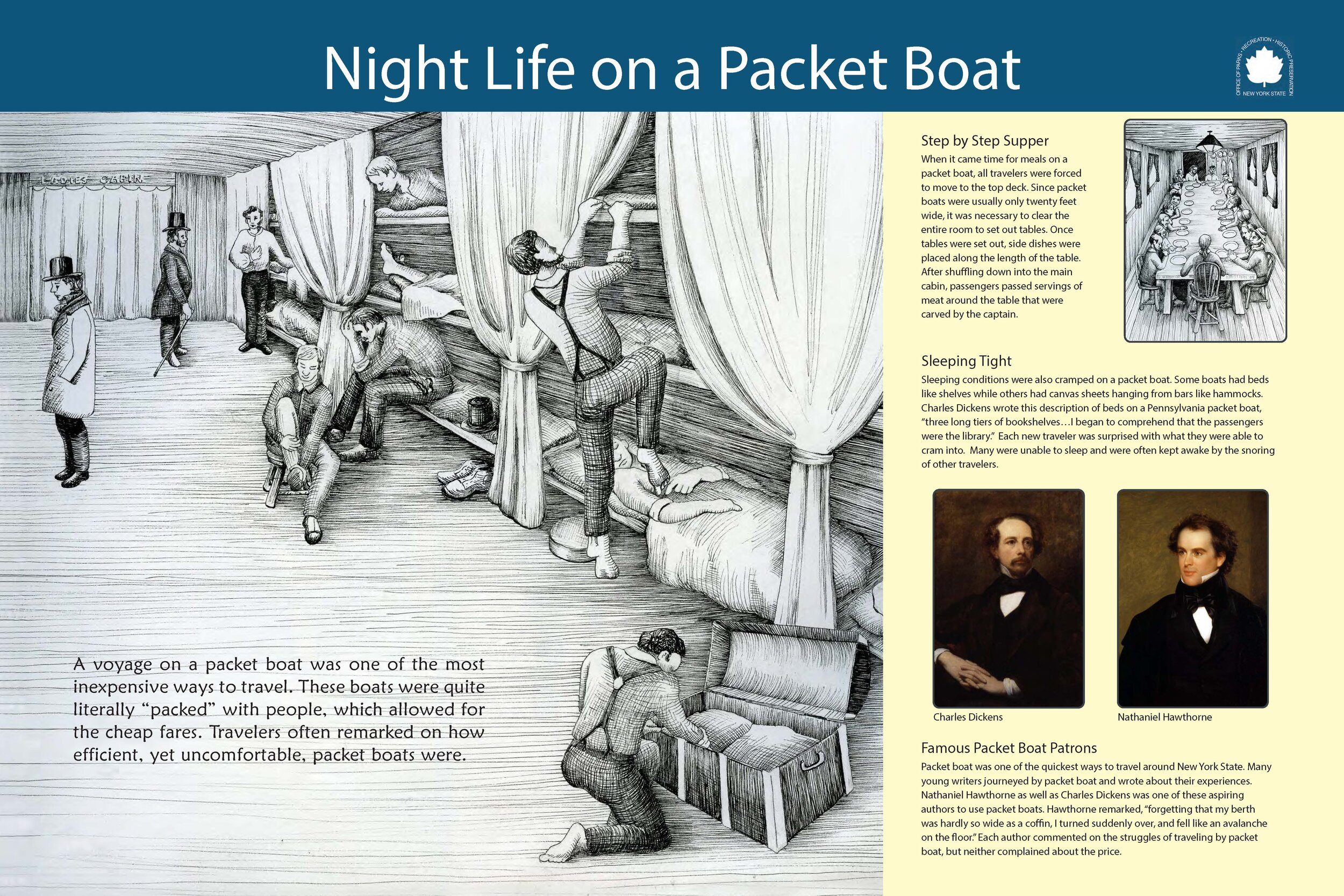
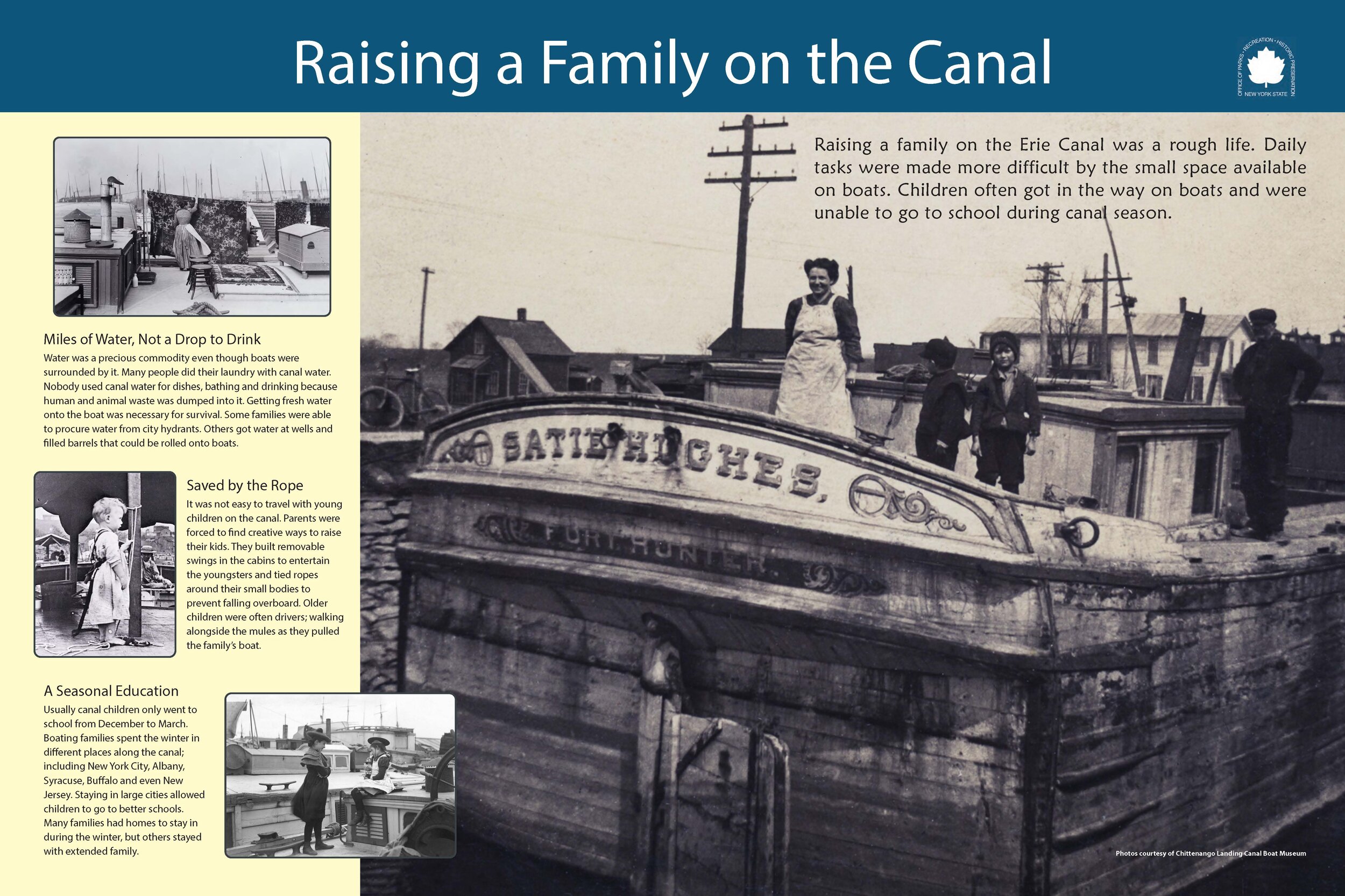
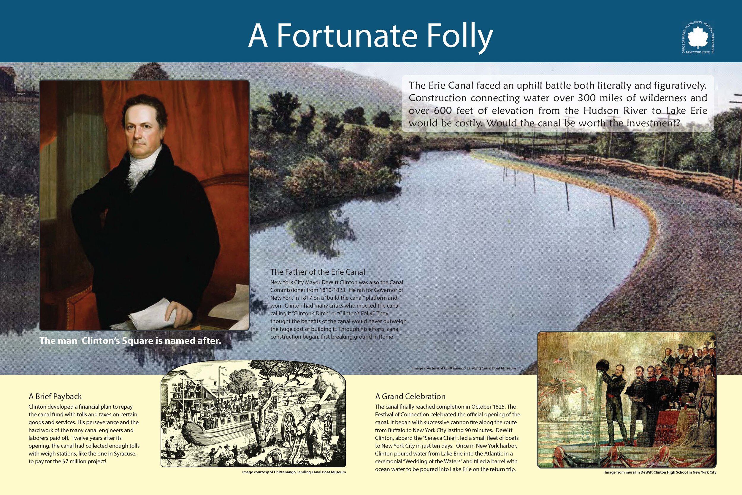
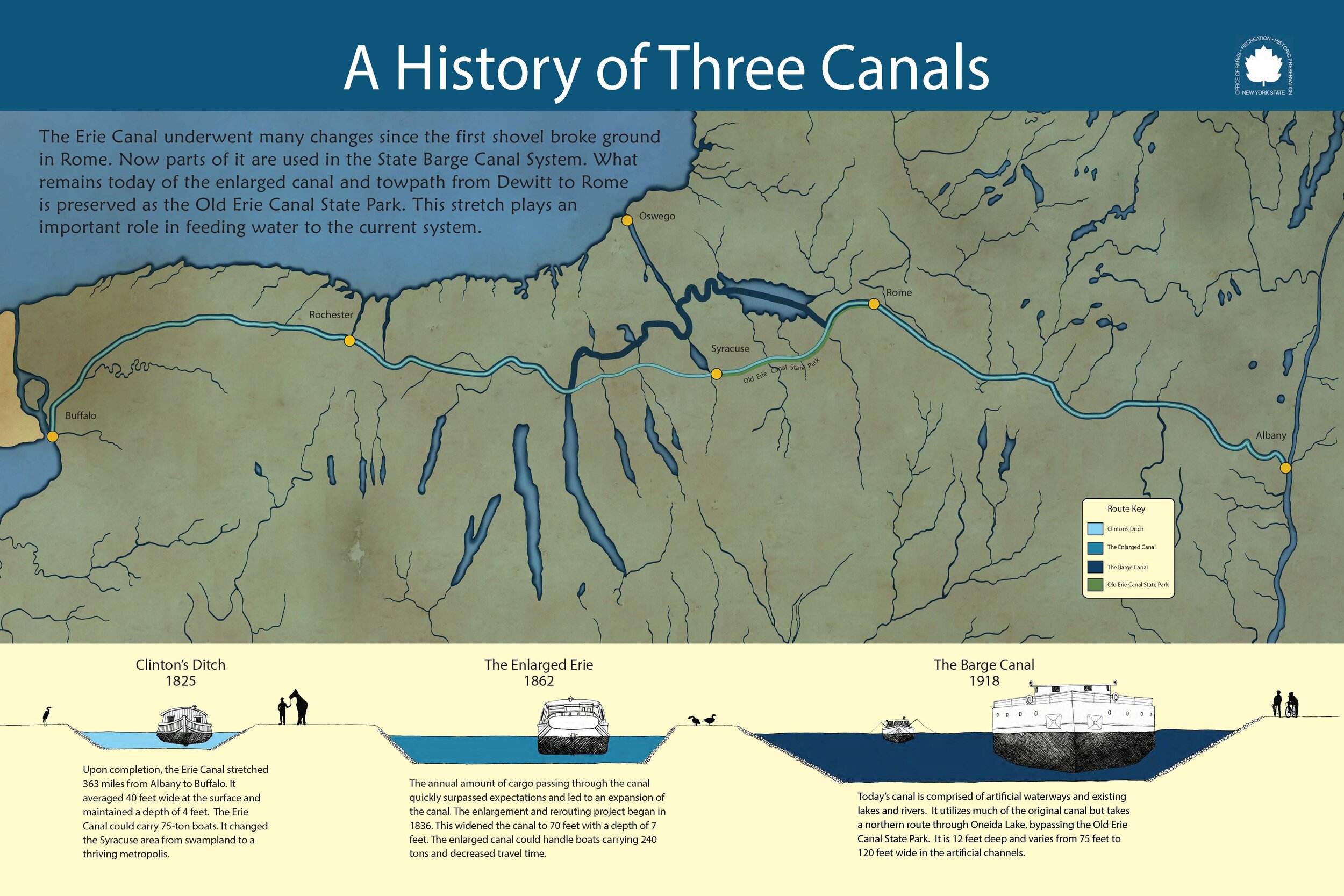
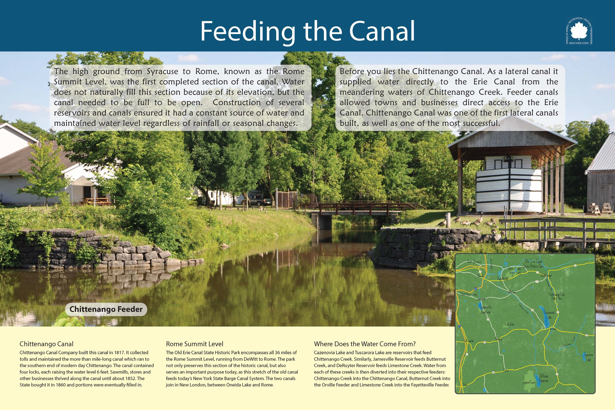
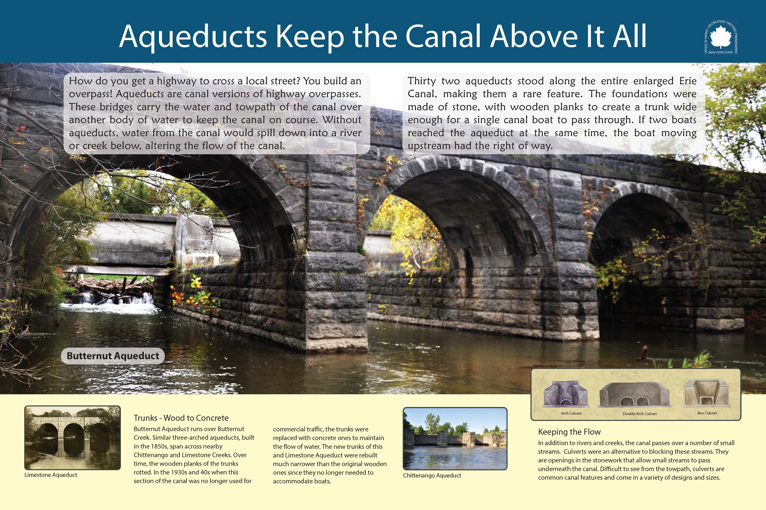
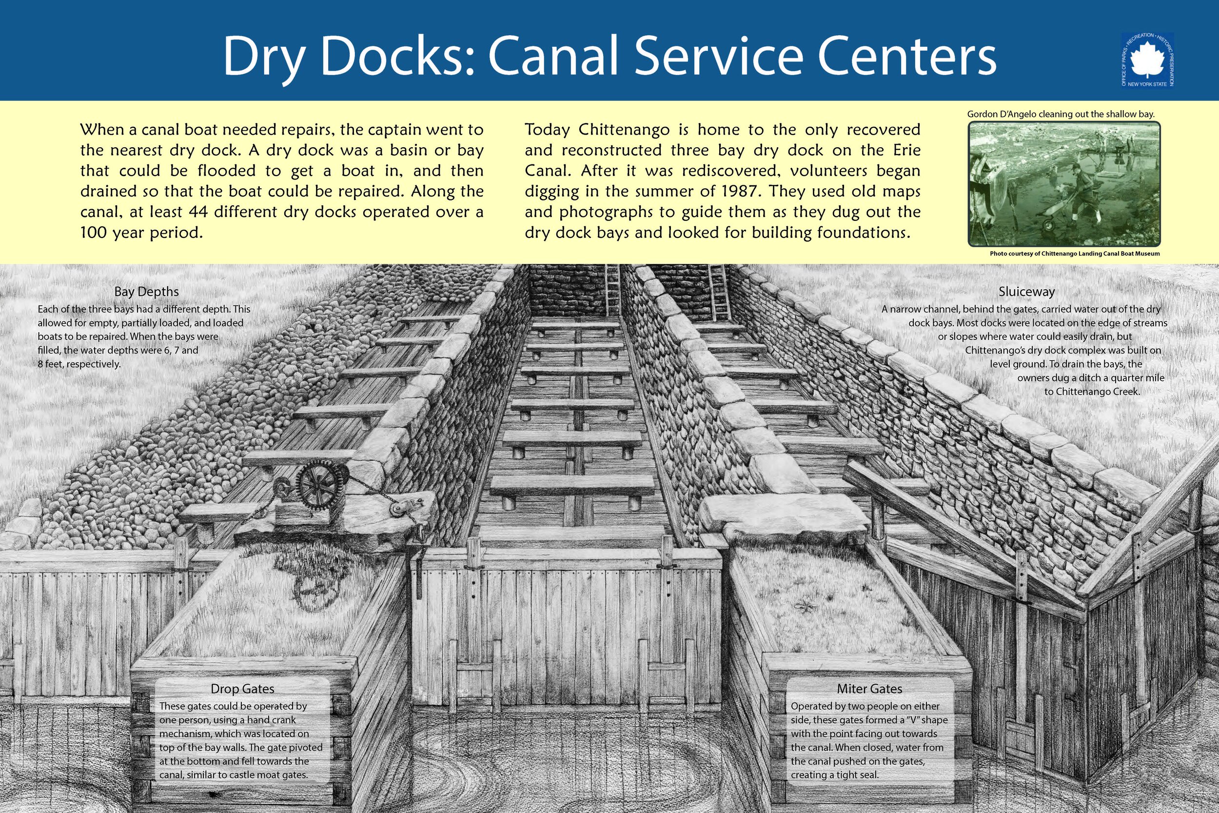
Explore each of the 21 interpretative signs found along the Old Erie Canal State Historic Park, and then get out on the trail to see them in person! These signs are along the trail from DeWitt to Canastota.

24building,launching boats.jpg
25MatildaJoslynGage.jpg
22engineers.jpg
21 packetboat.jpg
20wintering.jpg
19TheThingsThey Carried.jpg
18Family Life.jpg
17YankeeIngenuity.jpg
16 AFortunateFollykgc.jpg
15IceIndustry.jpg
14 towpath travelers.jpg
12Sig'sCircus.jpg
11AHistoryof3Canals.jpg
10Feeder-Chit.jpg
7Aqueduct - ButternutAb.jpg
6Aqueduct - Limestone2.jpg
5Aaqueduct-chit.jpg
4Dry Docksvh..jpg
3Cannery.jpg
2Boatyard.jpg
1Industry.jpg
24building,launching boats.jpg 25MatildaJoslynGage.jpg 22engineers.jpg 21 packetboat.jpg 20wintering.jpg 19TheThingsThey Carried.jpg 18Family Life.jpg 17YankeeIngenuity.jpg 16 AFortunateFollykgc.jpg 15IceIndustry.jpg 14 towpath travelers.jpg 12Sig'sCircus.jpg 11AHistoryof3Canals.jpg 10Feeder-Chit.jpg 7Aqueduct - ButternutAb.jpg 6Aqueduct - Limestone2.jpg 5Aaqueduct-chit.jpg 4Dry Docksvh..jpg 3Cannery.jpg 2Boatyard.jpg 1Industry.jpg
 
 
  • Who We Are/
    • About Us
    • Our Work
    • Contact
  • Boat Float 2025/
  • Bicentennial/
  • Experience the Canal/
    • Location
    • Everyday Paddling
    • History
    • Wildlife
    • Fish Species
    • Bike Rentals
    • Where To Stay
  • Gallery/
  • LWRP/
    • What is a LWRP?
    • Waterfront Revitalization Area
    • Public Input
    • Inventory and Proposed Projects
    • Old Erie Canal Water Study
  • Communities/
    • Communities
    • Syracuse
    • DeWitt
    • Fayetteville
    • Chittenango
    • Canastota
    • Wampsville
    • Oneida
    • Rome

Tour the Towpath

Bolder Landing Mule Logo.png
NYS Canals logo
NYSOPRHP.GIF